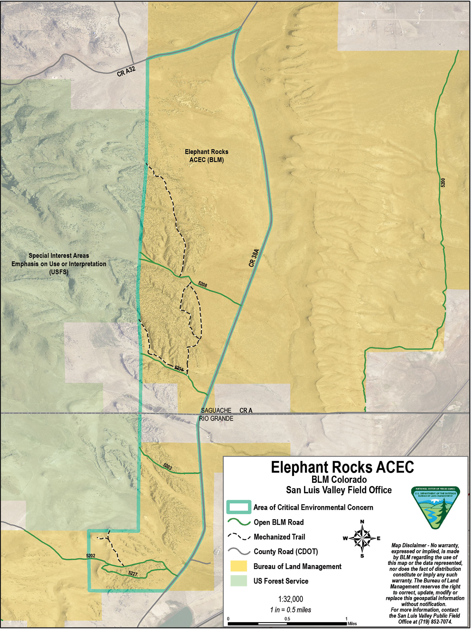
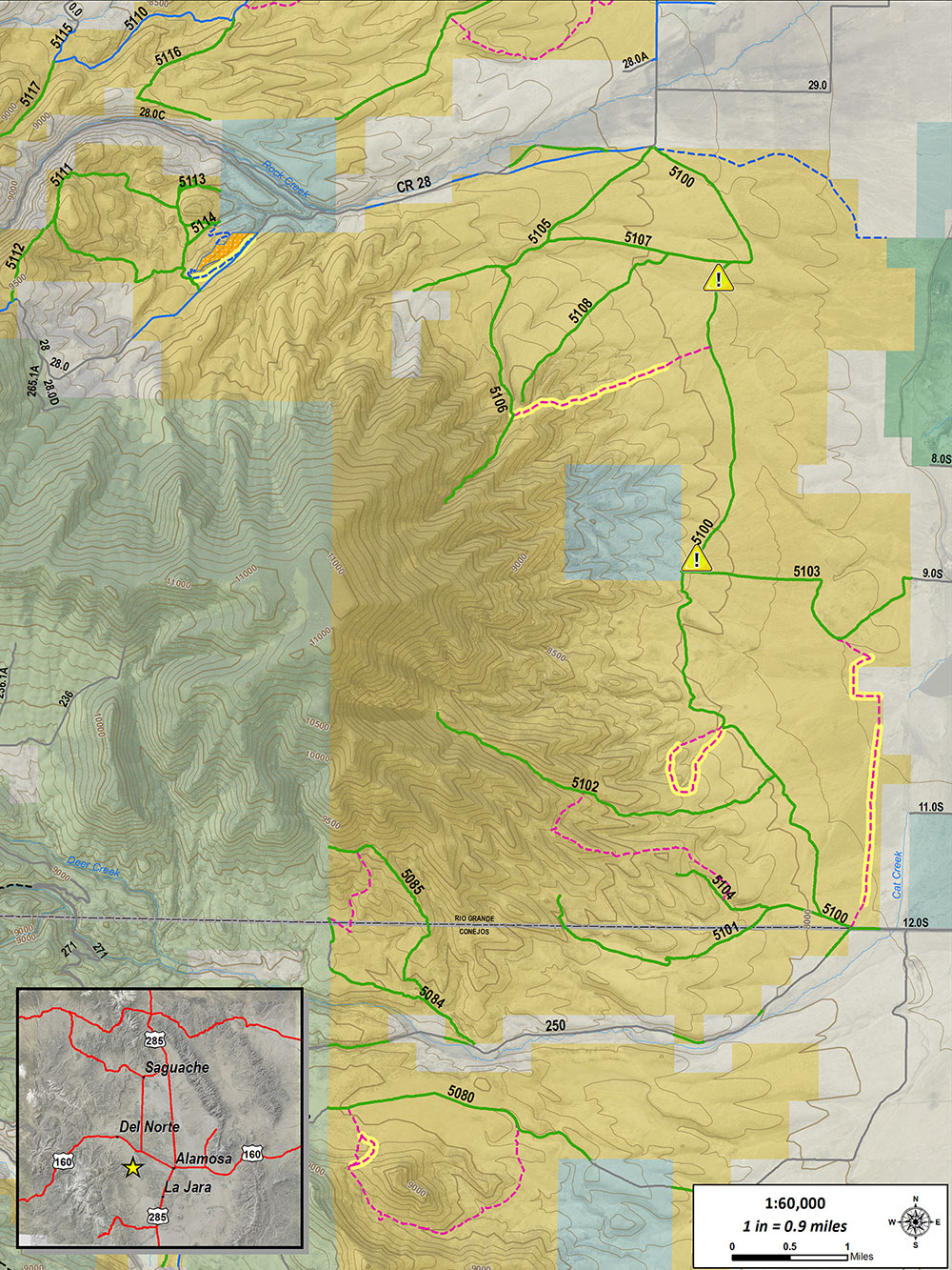
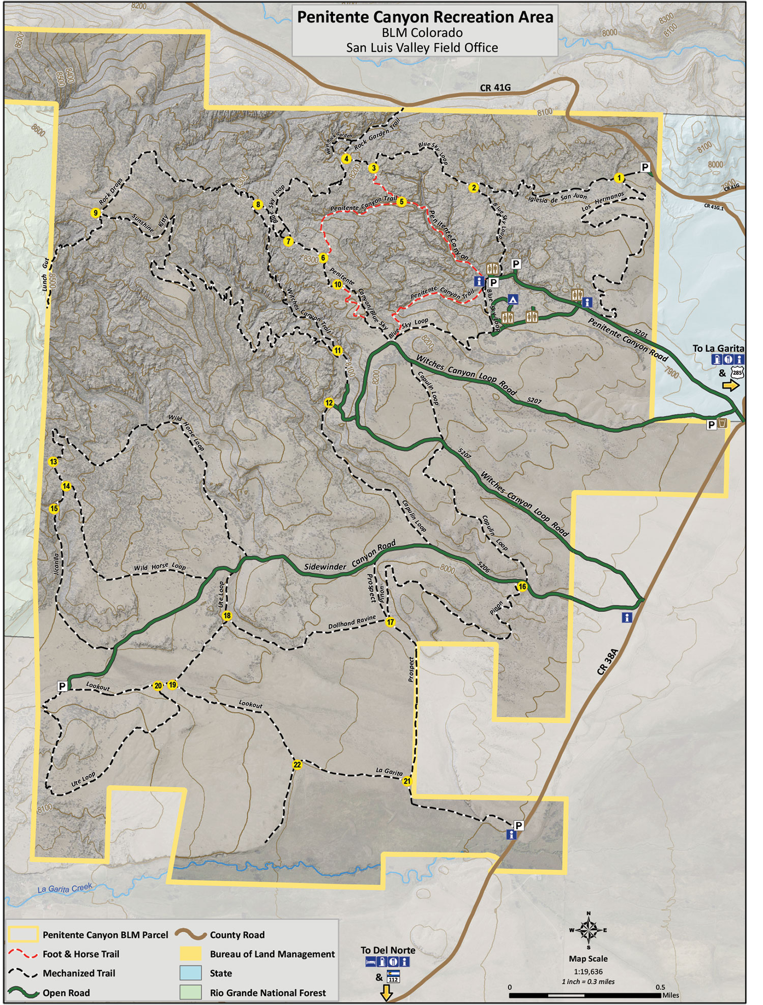
Trails & Maps

Limekiln/Stone Quarry Area

2022-05-27T14:26:56-06:00

The Limekiln Area entrance is on US Highway 160, about six miles east of Del Norte, at the Limekiln/Old Spanish Trail monument.  At an elevation of 7,900 feet, this 13,783-acre area is a large expanse of land with over nine miles of purpose-built, NEPA approved single-track trails – all are easy to intermediate “flow trails.”  In [...]

Limekiln/Stone Quarry Area2022-05-27T14:26:56-06:00

Middle Frisco Trail

2017-02-21T22:05:24-07:00

The USFS’s Middle Frisco Trail is a classic  6.3 mile, one-way, mountain bike ride or hike, climbing from 9,000 feet to 11,500 feet and ending at Frisco Lake.  The trail follows Middle San Francisco Creek through beautiful aspen groves for the first few miles.  It then climbs through a mix of open meadows and spruce/fir [...]

Middle Frisco Trail2017-02-21T22:05:24-07:00

Pronghorn Trails System

2022-05-27T14:18:12-06:00

The BLM's Pronghorn Trails System, totaling 9.5 miles of purpose-built single track trails, was constructed in the summer of 2016. The non-motorized natural surface trails are rated intermediate to advanced for mountain bikers. Located between County Rd. 13 and County Rd. 14, Pronghorn is south of Del Norte and connects to Del Norte's Lookout Mountain [...]

Pronghorn Trails System2022-05-27T14:18:12-06:00

Bishop Rock Area

2017-02-21T22:11:49-07:00

The BLM's Bishop Rock Area is in the hills just south of Monte Vista at an elevation of 8,280 feet, and is unmatched anywhere in the State of Colorado.  See Map Here  It contains a 40 acre slick-rock non-motorized open play area for bikers and hikers. For advanced riders, this freeform area of flowing rocks [...]

Bishop Rock Area2017-02-21T22:11:49-07:00

Stone Quarry Trail System

2022-05-27T14:22:02-06:00

The BLM’s Stone Quarry Trails area is a venue for mountain bikers and hikers alike at elevations from 7,900 to 8,200 feet.  It is located between Monte Vista and Del Norte, just off of US highway 160 to the south; the entrance being less than five miles east of Del Norte and ten miles west of Monte [...]

Stone Quarry Trail System2022-05-27T14:22:02-06:00

Penitente Canyon Trails System

2022-05-27T14:30:42-06:00

The BLM's Penitente Canyon Special Recreation Management Area has many trails for mountain bikers and hikers to enjoy among twisty rock canyons and towering boulders. A recently reworked trail system offers 21 miles of rides for all levels, from easy pedals to technical boulder jumping. These trails provide high alpine riding as well as some [...]

Penitente Canyon Trails System2022-05-27T14:30:42-06:00

Del Norte Parks & Trails

2017-02-21T22:13:11-07:00

Del Norte's Lookout Mountain is a USGS named summit at 8,475 feet. It is part of the Town of Del Norte's 200-acre Lookout Mountain Park Trails System. The recreational park and entire trails system, to date, comprises almost eight miles of natural surface, single track trails providing diverse experiences to hikers, runners, bicyclists, and equestrians. [...]

Del Norte Parks & Trails2017-02-21T22:13:11-07:00
Go to Top